
Trace a Barnegat Street by Address
For a named street, begin with one complete address and normalize the number, street name, municipality, and postal form. The address then leads to a parcel, usually through the Ocean County tax list or map. That parcel supplies block, lot, and sometimes qualifier information. Those identifiers are more durable than a street spelling when a deed, permit, or historic directory uses a different form. A street directory result can identify an owner, a voter registration presence, a permit applicant, or an old occupant, but those are different roles and should remain labeled that way.
- Use the Ocean County tax-list search with Barnegat and the available property location, block, lot, qualifier, or class. Write down the parcel identifiers returned or supplied by the assessor.
- Open the county map layers and inspect the target parcel and the next parcels along the street. Confirm that the street number belongs to the correct polygon before copying a block and lot into another system.
- Ask the Barnegat Tax Assessor for the current parcel-card or tax-map context when an owner-name question cannot be resolved from the public form. The municipal page does not offer a public owner-name search box.
- Search the current owner or other named party in the Ocean County Clerk index, then compare the deed's legal description, municipality, block, lot, and recording references with the parcel.
- Use the Barnegat permit system for dated construction or zoning evidence. For a lawful street-level voter question, use Ocean County's signed request procedure, then treat any name as a registration record rather than a full household list.
Move in this order because the sources speak different languages. The Barnegat map speaks in polygons, the Barnegat tax list in parcels, the Ocean Clerk index in parties and legal identifiers, and the Barnegat permit portal in text addresses and project fields. Matching two identifiers before drawing a conclusion keeps a Barnegat street search grounded.
Use Barnegat Street Directory Parcel Fields
The Barnegat Tax Assessor is the municipal contact for assessment and tax-map questions. The county's public tax-list interface is the practical online starting point. It is designed around property identifiers, so a street-directory researcher may need to use the property-location field first, then narrow the result with the block and lot shown on a map or tax bill. An annual assessment record can lag a transfer made after the file date. A recorded deed is the better source for the date and legal terms of that transfer.
| Tax-list field | How it works in Barnegat research |
|---|---|
| Municipality | Select or confirm Barnegat Township before reading a parcel result. |
| Block and lot | Tax-map parcel identifiers that connect the county list, municipal assessment context, permits, and many deeds. |
| Qualifier | An optional subparcel identifier that helps separate a unit or other qualified parcel. |
| Property class | An optional class filter; the captured interface did not expose every dynamic choice. |
| Property location | Street or location text, useful when the block and lot are not yet known. |
The Barnegat assessor page gives tax-map instructions through a master key map and page selection. Calling the Barnegat office is the documented fallback for the municipal parcel card or for help interpreting a map. Keep the owner or mailing contact separate from the situs address, the physical place of the Barnegat parcel. A mailing contact can be an agent, trust, lender, or person who does not live at the street address.
The Barnegat Tax Assessor source page shows the local assessment and tax-map guidance used for this street-directory step.
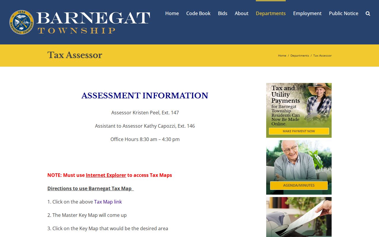
The assessor-page image is a reminder that Barnegat tax-map guidance is a local office resource, while the county list provides the searchable parcel fields. Use both when a street name alone is too broad.
Note: Assessment information can be useful context, but the Clerk's recorded instrument verifies a transfer and its legal description.
Browse Barnegat Streets on Parcel Layers
Ocean County's GIS program gives the street-by-street view that the tax-list form does not. Its documented layers include municipal boundaries, cadastral parcels, easements and rights-of-way, aerial imagery, zoning, FEMA flood zones, tax maps, wetlands, streams, subdivisions, and site plans. Zoom to the address, turn on parcel or tax-map information, and click the target polygon before comparing nearby lots. A corner lot, rear lot, easement, open-space tract, or non-addressed parcel can look close on the map without being the next dwelling along the street.
The statewide NJGIN parcel resource adds address, county, municipality, block, and lot searching. It also cautions that names can be redacted under Daniel's Law for covered people. A blank owner field is not evidence that the parcel has no owner. Carry a questioned block and lot to the local assessor or Clerk instead of trying to work around a redaction.
The Ocean County GIS program page is the source for the parcel and layer image below.
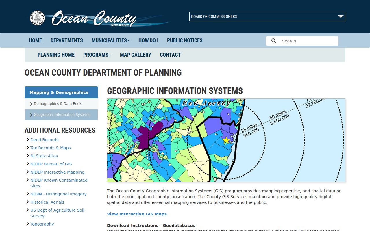
This GIS image shows the official county entry point for parcel and map-layer research. It provides spatial context, not a certified ownership determination.
Check Barnegat Street Permit Records
Barnegat's FTG Citizen Services search adds an address-keyed trail that is separate from Barnegat deeds. The Barnegat construction search offers permit type, status, date window, application or permit number, violation ID, contractor or agent, street number and name, city, block, postal code, lot, and qualifier. The Barnegat zoning search has similar identifiers and status choices. A permit can establish that a project, contractor relationship, occupancy-related filing, addition, deck, pool, demolition, or other work was recorded. It is not proof of ownership or daily residency.
The Barnegat portal's street-name instruction is unusually useful: enter only the street name without directionals or street types. If a search does not find a Barnegat record, test the bare street word before assuming the address has no file. When the online result is too recent or incomplete, the Barnegat Municipal Clerk OPRA form can route a specific address, block, and lot request to Construction, Planning/Zoning, Code, the Assessor, or another custodian. The form allows pickup, mail, on-site inspection, fax, and email.
The Barnegat construction search is the source for the field view below.
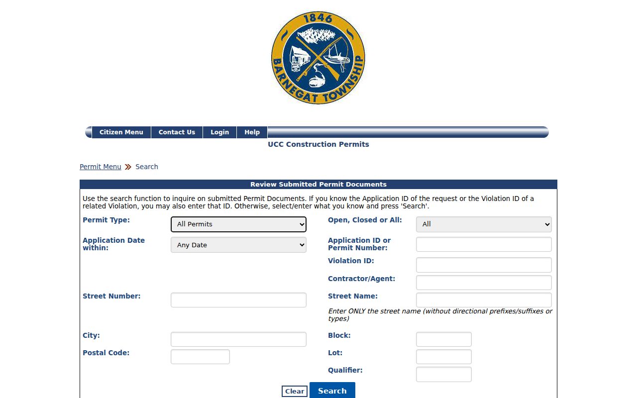
The construction-search image shows why street number, block, lot, contractor, and postal code are useful alternate paths when a street name produces too many matches.
The Barnegat zoning search is the source for this related permit view.
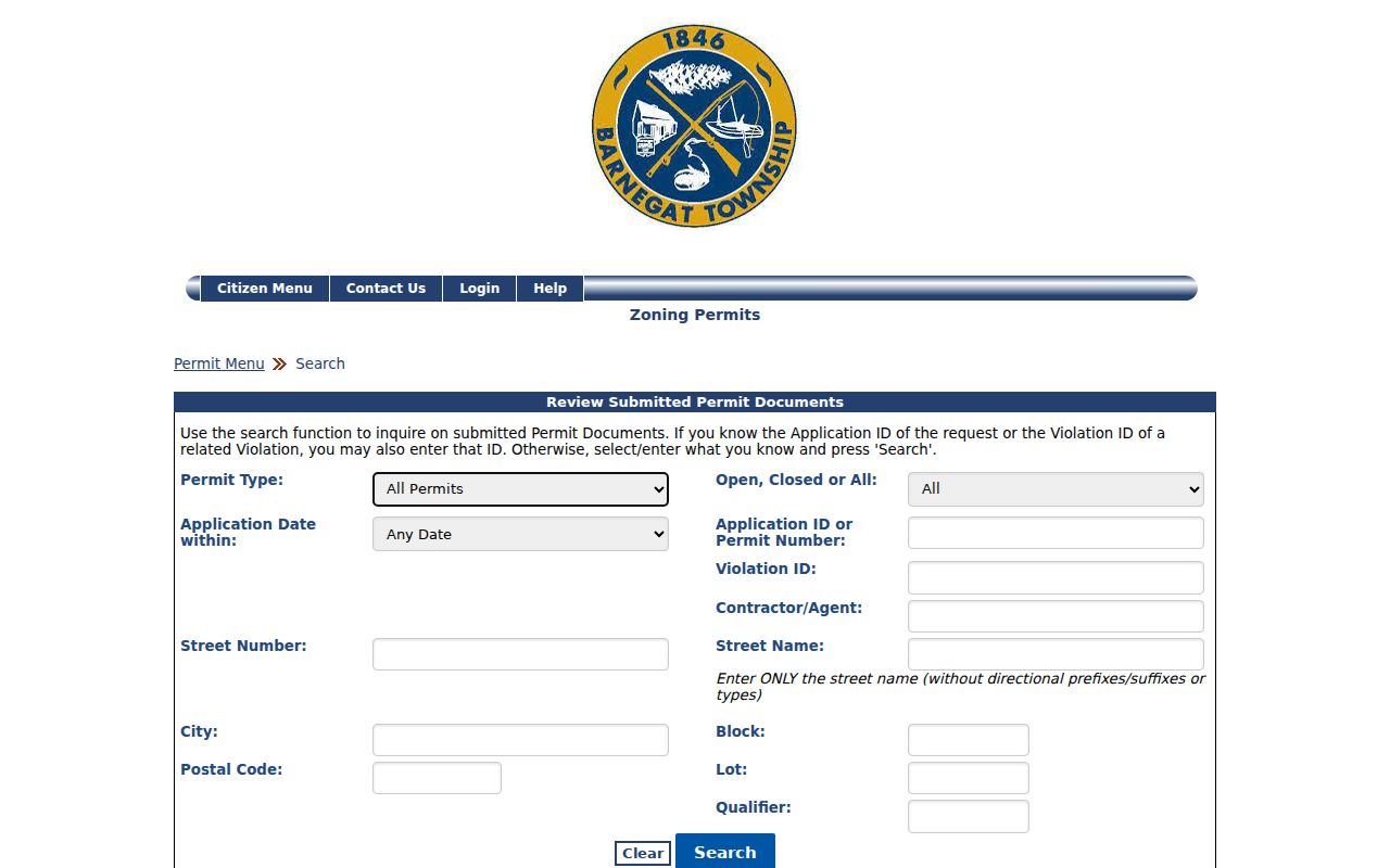
The zoning-search image confirms the separate permit route and its Open, Closed, or All status choices. A dated permit should be compared with the parcel and deed before assigning it to a person.
Note: The township documents online permit searching, but it does not publish a verified historical cutoff for every older permit file.
Match Barnegat Street Directory Records
A useful Barnegat street directory is a chain of records, not a single roster. The tax list and assessor locate the parcel. GIS checks its position. The Clerk records transfers and legal descriptions. Construction and zoning files add dated work. Voter records can show a registered-voter presence through the lawful request channel. Older reverse directories, newspapers, and census sources can supply a dated household clue. Each source has a different date and purpose, so none should be relabeled as a universal list of everyone who lives on a street.
| Address-keyed source | Barnegat keeper | Street evidence | Access route |
|---|---|---|---|
| Barnegat assessment and tax list | Barnegat Assessor and Ocean County Board of Taxation | Barnegat property location, owner or mailing context, block, lot, class, and assessment data | County query, assessor contact, or specific OPRA request |
| Barnegat parcel map | Ocean County GIS and NJGIN | Barnegat parcel geometry, tax-map relation, zoning, easements, imagery, and nearby lots | Public map or downloads; owner names can be redacted |
| Barnegat recorded instruments | Ocean County Clerk | Grantor, grantee, date, consideration, legal description, block, lot, and linked Barnegat land history | Online official-record index from April 1, 1977, then Clerk or archive routes |
| Barnegat construction and zoning | Barnegat Construction and Code | Permit, contractor, Barnegat address, block, lot, work scope, and violation identifiers | FTG search, department contact, or OPRA |
| Barnegat voter list | Ocean County Board of Elections | Barnegat street and residence-number registration records as permitted by statute | Signed OPRA form and Election Order for a comprehensive list |
Parcel identifiers are the bridge. The street name gets a search started, but the block, lot, qualifier, and legal description make the match stronger when several Barnegat addresses look similar. For a current-person question rather than a whole street, the separate Barnegat resident lookup route emphasizes confirming one name across independent custodians.
Follow Barnegat Street Deed Clues
The Ocean County official-record browser search is indexed chiefly by parties and legal identifiers rather than as a guaranteed street-address search. It permits party name, document type, town, date, instrument number, book and page, lot and block, legal-description, map, and parcel modes. Start with the owner identified on the tax side, search the person as grantee, narrow to Barnegat and a useful date span, and inspect the document's legal description. For a long street, repeat the parcel process for each selected lot rather than expecting one street query to return every transfer.
The Clerk says public data is unofficial and advises spelling variations. Result statuses distinguish verified records from replaced or correction records. Deed-cover information can include parties, block, lot, municipality, consideration, and a grantee mailing address. That mailing address can help identify correspondence, but it does not establish that the grantee occupies the parcel. The online index begins April 1, 1977. Earlier deeds need the Clerk, New Jersey State Archives, or FamilySearch county-deed route.
- Parcel
- A defined tract in the tax system, commonly identified in Ocean County by municipality, block, lot, and sometimes qualifier.
- Situs address
- The physical street location of a parcel. It differs from a mailing address used for tax or deed correspondence.
- Plat or tax map
- A mapped depiction of parcels, roads, and identifiers. It helps locate land but is not itself a certified title decision.
- Criss-cross directory
- A reverse directory that may arrange a dated volume by street and number to give an occupant lead for that edition.
Note: A party index and a street address describe the same property only after the legal parcel details have been compared.
Request Barnegat Street Voter Evidence
New Jersey's personal Am I Registered? tool is for an individual status check and requires the name spelling supplied by Ocean County. State guidance warns that a hyphen, middle initial, married-name change, or nickname can affect a match. It is not a public free-form street browser. For a street or block record, Ocean County Elections requires a completed signed OPRA form by fax or mail and an Election Order for a comprehensive list. The county states a 7 to 10 working-day turnaround, with longer processing during election cycles.
N.J.S.A. 19:31-18 describes the certified list as name, address, date of birth, party affiliation, and voting history, without signatures. Public-list access does not turn every underlying registration field into a directory detail. Protected addresses, signatures, full identification numbers, and other restricted information should remain outside a street research file. An inactive voter is an address-maintenance signal, not proof that a person moved away.
Read Barnegat Street Directory History
Postal labels can derail an address search. Barnegat's main municipal postal identity is 08005, but edge areas can use Manahawkin or Waretown identities. Use the USPS ZIP lookup to confirm a full address before searching a postal field. ZIP routing does not define township limits. Ocean tax and GIS records use municipality, block, and lot; the Clerk uses parties and legal descriptions; the FTG portal accepts postal code with the street and parcel fields.
Older search results need an additional jurisdiction check. Barnegat was formed as Union Township in 1846, while Ocean County was created from southern Monmouth County in 1850. An older deed or directory can therefore use Union Township or Monmouth County. The historic core around Bay Avenue, Main Street, Collins-town, and Lower Shore Roads offers useful context, but the legal description remains the bridge to a modern parcel. This is a records-history issue, not proof that a street was township-wide renumbered, because no verified renumbering year was located.
The Ocean County Library genealogy resources are the Barnegat fallback for reverse directories, telephone books, yearbooks, clippings, microfilm, and genealogy databases when a current address source goes quiet. Its published resources include HeritageQuest, in-branch Ancestry Library Edition, the Asbury Park Press archive, and the New Jersey Courier archive. Ask the Barnegat reference desk for a particular Barnegat or Union Township address rather than assuming a reverse-directory year exists online.
Check Barnegat Street Record Updates
Barnegat parcel research has a current caution. In August 2026, NJGIN reported completed updates to parcel data services, applications, and downloads that included Ocean County geometry changes. The same Barnegat research route retains Daniel's Law owner-name redactions in hosted parcel data. A Barnegat map popup can therefore change with a Barnegat data update or show a redacted name without changing the underlying Barnegat ownership record.
For a disputed Barnegat address, compare the Barnegat assessor, the Ocean County Clerk, and the current Barnegat map layer rather than relying on one state-hosted parcel display. The township's documented permit search is another modern Barnegat address source, distinct from the Clerk's 1977 online-record cutoff. Keep the Barnegat tax identifier, Barnegat map reference, Barnegat deed reference, Barnegat permit ID, and Barnegat request date together. Each Barnegat source answers a different question about the same street.
Set Limits on a Barnegat Street Directory
Barnegat address records have real gaps. A Barnegat property roll may name an owner or mailing contact but not every person at a Barnegat address. A Barnegat permit can name an applicant or contractor. A voter list documents a registration subject to public-list rules. Utility customer files are not public resident rolls, and motor-vehicle address data is restricted. The New Jersey Address Confidentiality Program can provide eligible participants a substitute address, while Daniel's Law protections can lead to redactions for covered people and their families.
Use the information for personal, lawful research such as family history, estate work, property curiosity, or verifying a record with its custodian. Do not use a Barnegat street directory result to stalk, harass, intimidate, or harm anyone. A redaction, absent result, or stale mailing address deserves a check with the record office, not a guess about a person's whereabouts.
Lawful use. Barnegat address records can support personal research, but protected information and absent household details must be respected. Do not use any result to track, harass, or harm a person.